Glacier National Park: Hike Iceberg Lake and Don't Skip the Bear Spray
- Sep 18, 2018
- 3 min read
Updated: Mar 20
About Glacier National Park
Glacier National Park (GNP) is called the ‘crown of the continent’ for a reason. GNP is impossibly scenic, with every turn in the trail providing an amazing view of mountains, jagged peaks, waterfalls, glacier-carved valleys, lakes, wildlife, and, of course, glaciers. The 1.4 million acre park contains some of the most beautiful mountain scenery in the west. These are the views you will never forget! Of the estimated 150 glaciers which existed in the park during the mid-19th century, only 25 active glaciers remained by 2010. Scientists estimate that all the active glaciers may disappear by 2030 if current climate patterns persist.
Why Hike Iceberg Lake
The Iceberg Lake Trail in GNP offers one of the most rewarding hikes in the park without requiring technical skill, delivering dramatic scenery from start to finish. As the trail climbs through subalpine meadows, you’re surrounded by wildflowers while hiking beneath towering peaks. The payoff is Iceberg Lake itself. A cold, turquoise basin with sheer cliffs rise directly from the water, creating a natural amphitheater that feels both massive and quiet. It's a hike in a park known for unforgettable landscapes.
Hike Distance: 9.6 miles
Elevation Gain: 1,275 feet
TrailsNH Hiking Difficulty Calculator: 156 – Strenuous

Click here to navigate to the TrailsNH website for a description of the hiking difficulty calculator
Let's Start Hiking
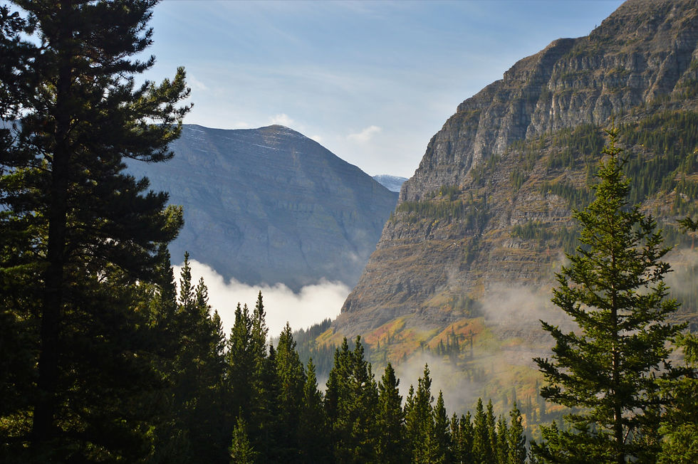
Iceberg Lake Hike in the Many Glaciers area was our last hike in the park. The trail begins behind the cabins near the Swiftcurrent Motor Inn. Although the hike started with a steep 0.2-mile push, it quickly turned into a pleasant, gradual climb hugging Henkel Mountain, despite spending the first half-hour in thick clouds. Unfortunately we spent the first 30 minutes of the hike in low clouds.

As the clouds lifted and temperatures rose, we got our first look at the landscape, dominated by Mt. Wilbur (9,326 ft) rising dramatically over 4,500 feet above Swiftwater Lake.

We spotted this sign near the Iceberg Lake Trail, which means it’s time to make noise, shake our bear bells, and get the spray ready


Early clouds still blanketed the valley floor.
Even though we had a way to go, we could see the ridge line of Mt Wilbur extending from the peak and forming a glacial cirque. Geology 101: Iceberg Lake lies in a 'cirque' which is a bowl-shaped valley formed by glacial erosion typically surrounded on three sides by steep cliffs.

The terrain alternated between forest and alpine meadows until we reached the head of the valley.


The changing colors of the grass and ground cover indicated that fall was approaching.

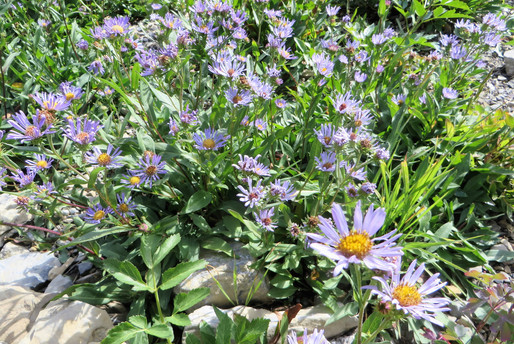
A few remaining wildflowers were still in bloom.


Geology 101 Lesson 2: The Ptarmigan Wall, which towers 1,500 feet above the trail, consists of a narrow, pinnacle-studded ridge guarded by sheer cliffs on either side. The wall is known as an arête, defined as a thin ridge of rock separating two valleys that have been carved by glaciers. In this case, the Ptarmigan Wall separates the Many Glacier valley from the Belly River valley.

The trail began a gradual descent as it crossed Iceberg Creek.

Shortly after the crossing, we reached a small beautiful glacial lake.

A short time later Iceberg Lake came into view, dramatic and framed by 3,000-foot cliffs, with patches of snow still dotting the ledges and base.
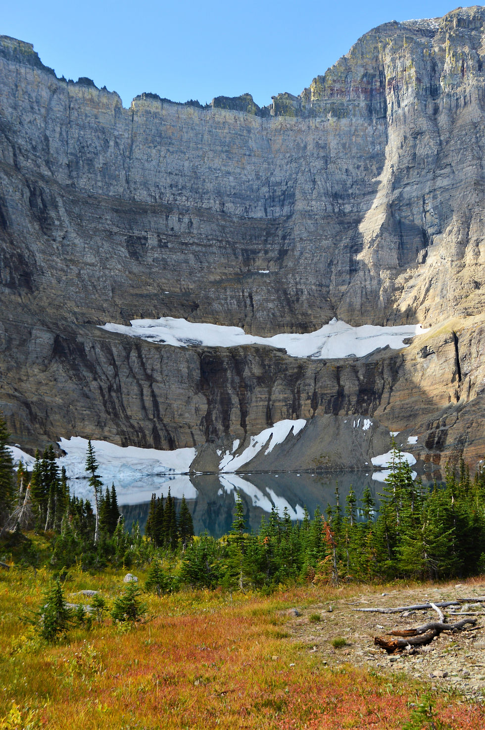
It was tough to get a good photo of the entire lake much like trying to capture the entirety of a grand opera house in one shot."

Even with perfect weather, it was easy to find a quiet, isolated spot for lunch.

Time to head back and wrap up this amazing trip to GNP.

Soaking up the perfect weather and this incredible view of the Ptarmigan Wall on the way back.


Here is the last picture of Glacier National Park. The trip and over 38 miles of hiking was everything we had hoped for and more.

170918


Comments