Getting Lost: Hiking Boo Hoff and Lost Canyon Loop
- Apr 15, 2020
- 8 min read
Updated: Nov 30, 2025
Well today didn't go quite as planned but that's the life of a hiker.
What we actually hiked
Hike Distance: 15.7 miles (I'll explain how we tacked on an extra 3 miles)
Elevation Gain: 2,290 feet
TrailsNH Hiking Difficulty Calculator: 268 – Challenging
What we planned to hike
Hike Distance: 12.7 miles (I'll explain how we tacked on an extra 3 miles)
Elevation Gain: 2,290 feet
TrailsNH Hiking Difficulty Calculator: 241 – Very Strenuous

Click here to navigate to the TrailsNH website for a description of the hiking difficulty calculator
Let's Start Hiking the Boo Hoof Segment
We knew this trail in the Santa Rosa mountains would be challenging and it lived up to those expectations. The trail head is located in La Quinta Cove, one of the more beautiful areas in the valley. Despite being within sight of the residential neighborhoods, the views are immediate. There were a few other people on the trail as we started, but they veered off in another direction shortly after we first saw them.

The Santa Rosa Mountains are a companion range to the San Jacinto Mountains. The Santa Rosas extend for approximately 30 miles along the western side of the Coachella Valley and are about 15 miles wide at the north end, narrowing to fewer than 10 miles in the south. A simplified map of these two mountain ranges is provided below.

Unlike the San Jacinto range the higher elevations of the Santa Rosas are set back a considerable distance from the valley. As a consequence, they appear to be much lower in elevation when viewed from the desert cities of the valley.

In fact, the highest peak in the Santa Rosas, Toro Peak (8,716 ft), is substantially lower than many peaks of the San Jacinto mountains. In general, elevations in this range seldom exceed 6,000 feet.

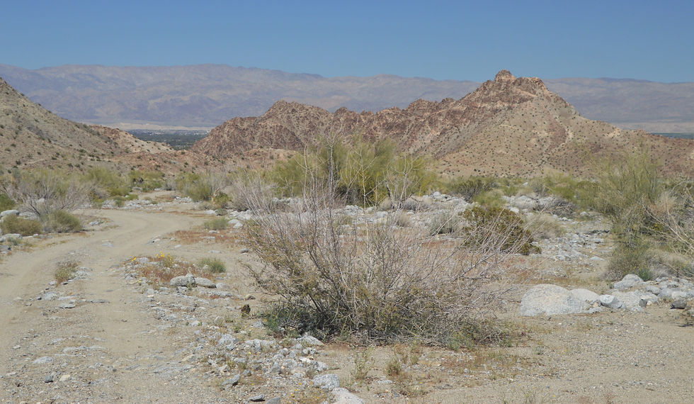
Initially the trail followed a wash for the first mile or so.

Rocks of the lower elevations of these mountains have a unique coloration. They commonly appear to be shades of mahogany, or reddish-brown. This is desert varnish, a coating that develops in hot, arid regions on exposed surfaces of granitic rocks that contain metallic minerals. Desert varnish is caused by the desert weathering process where there is a significant difference in day and night temperatures. Minerals rich in oxides of iron and manganese helped by nighttime moisture leach small amounts of minerals from the rock surface. Daytime sunlight evaporates the moisture, redepositing the mineral as a surface stain. The cumulative effect of this is a gradual darkening of the rock surface. It's is extremely slow, requiring centuries for the brown coating to form. Therefore, you only see desert varnish develop on surfaces or mountain sides that are not subject to disturbance.


The Santa Rosas began to form some 50 million years ago as a result of increasing pressure from tectonic plate movement (i.e. Pacific Plate started to subduct under the North American Plate). They are essentially an uplifted block of crust forced by these movements along faults.


We stumbled across this huge field of poppies covering the hillside.


If you look closely, you can trace the trail as it winds its way along the left edge of the gash in the mountain.

I guess they use to allow ATVs in the area. I wonder how long this chassis has been left to rust.

Unlike mountains on the East Coast which have more rounded crest and broad valleys, these younger mountains have V-shaped gashes and canyons with steep sides, and peaks that are more jagged and irregular.

The final climb to the high point of the Boo Hoff trail.


The high point of the trail is 1,918 feet above sea level. What a beautiful view of the desert cities.

I couldn't bare to mark up a great picture like the one above, so I've traced the path we followed to the top on the same picture. Total travel time 110 minutes, distance 3.9 miles, elevation gain of 1600 feet with a greater than 20% grade for the last 1.5 miles.

Just as it had been a steady uphill climb, it would now be a rapid descent for 3 miles until we reached the mouth of Lost Canyon near the valley floor.

The view looking at the trail as it winds its way back to the valley. The Salton Sea was visible in the distance through the haze (top right of center).

I love this view of the town of La Quinta with the City of Indio in the distance and the Little San Bernardino Mountains on the opposite side of the valley. The Little San Bernardino Mountains are considerably lower in elevation than either the Santa Rosa or San Jacinto Mountains. The most striking aspect of the this range is the uniquely flat and uniform crestline apparent from any viewpoint in the valley.

After a well-deserved break we began our descent through a small cholla cactus forest with flowering ocotillos lining the trail.

These teddy bear cholla cactus can grow 1-5 feet tall. The branches or lobes are at the top of the trunk and are nearly horizontal. Lower branches typically fall off and the trunk darkens with age. Stems from these cactus detach easily and the ground around a mature plant is often littered with scattered 'cholla balls'. These cholla balls can root immediately but more often they attach to passing animals and when they finally fall off, the spines contact the ground and begin rooting. This reproduction method often results in small pockets of cholla forests like these.

Ocotillo, which are shrubs and not cacti, have adapted to dry desert conditions by leafing only after significant rainfall events, and if there is additional sufficient rain, flowering, fruiting and then dropping all their leaves and going dormant until the next rain happens. Under the right sequence of rain events they can repeat this sequence up to three times in a single year. It's clear these ocotillos were convinced that enough rain had fallen recently.


Here's a great closeup of the agricultural fields of the Imperial Valley. So much of the water for these lush green fields is supplied by irrigation canals carrying water from the Colorado River.


After 3 miles and a descent of approximately 800 feet, we reached the wash leading into Lost Canyon. A huge ocotillo stood at the entrance to the wash.

Here is where we made our mistake. We planned to hike Boo Hoff for another 1.5 miles down to the canyon mouth near the valley floor and then follow the canyon back to the wash opening. We'd then retrace our steps back to the trail high point and ultimately to the trailhead in La Quinta Cove. It would be like a 'lollipop' route versus an 'out and back' or' loop' trail.

The terrain leading back to the valley floor was similar to the terrain we had hiked earlier. We had seen only a handful of people during the hike. Such a feeling of isolation here.


We were getting closer to the valley floor.


Finally, we saw the path leading into the mouth of the canyon.

Hiking the Lost Canyon Segment
After hiking 6.6 miles we entered Lost Canyon.

Boulders ranging in size from suitcases to trailers littered the canyon floor.


The further we walked the higher the canyon walls rose. We found a shady spot against the canyon wall for our lunch break.

A nice picture while we were both still happy.

While we were hiking, someone yelled to us from the top of the canyon that we should check out the stream and waterfall. To reach the falls we needed to veer slightly off trail to a small side opening on our left.

Unlike the San Jacinto Mountains, the lower elevation of the Santa Rosa Mountains does not block or capture eastward-moving weather systems. This means that storms pass over the Santa Rosa without dropping their rain so these mountains are significantly dryer and have no permanent streams. We could hear the water long before we saw it.

It was amazing to see the waterfall this late in the spring. Honestly, we didn't know about the stream or waterfall at the start of the hike.

We backtracked from the falls and then hiked over a small ridge to rejoin the trail.


We were looking for signs of the trail that would bring us to the top of the canyon.

No Way Out
We reached the area where the climb out of the canyon began but struggled to find a path up what has been described as a 125-150 rock wall. Our best option looked like it was through this opening.

Climbing over the huge boulders was slow but not difficult. Our problems began as we climbed higher, the footing became less secure and each step had to be carefully planned out.

After climbing 30-40 feet, I went ahead of Dave to test out what I thought was a safe route. This was the last picture I felt comfortable taking as I climbed higher. Ten minutes later I returned unsuccessful. We headed back to the canyon floor after climbing less than 1/3 of the way to the top.


We walked around the area looking for an alternative approach. I was still feeling strong despite hiking 8+ miles, so over the next 40 minutes I made several more attempts at scaling the wall — all were unsuccessful. Here's Dave expression his 'displeasure' at my continued attempts to climb out of the canyon.

One positive outcome of my search was I discovered a small palm tree stand wedged into the canyon wall.

Backtracking to the Boo Hoof Trail
We came to the conclusion that we'd need to hike out of the canyon and then return to La Quinta Cove following the southern half of Boo Hoff trail. We had planned for a 13 mile hike and it would now be 15-16 miles. Although it was getting hot and we had wasted close to an hour trying to climb the canyon walls, we still had plenty of water. The only thing we were suffering from was frustration. In hindsight, we should have followed the green path below by entering the canyon at the wash opening and then hiked down to the canyon mouth on the valley floor. Once out of the canyon we'd turn left and follow the Boo Hoff trail back to the high point and ultimately to the trail head in La Quinta.

Fortunately, most of the trail was level terrain so we could move quickly.

We skirted around 'The Quarry at La Quinta' golf course and began a moderate climb back to La Quinta Cove.

Along the way there were excellent examples of desert varnish on the hills.

Approaching the main wash where we had started our hike almost 9 hours ago. We had covered the last 7+ miles in slightly under 3 hours.

Here is the hike map. I've circled where we entered Lost Canyon. The first excursion to the left was the waterfall that we found. The second excursion to the left was searching for the path out of the canyon and the palm tree stand I discovered along the way. I've made a promise to myself that when we return to Palm Desert, we'll try to complete this trail again. We had gotten so close!

As soon as we got home, I made a chocolate and peanut butter smoothie and Dave had a glass of beer. We weren't toasting our success, but rather that we had survived a very long and frustrating day hiking in the Santa Rosa Wilderness.


Comments