Fort Clatsop: Exploring Lewis and Clark's Winter Camp in Oregon
Our drive from Seattle to Oregon's northern coast included one unexpected stop that proved well worth the detour. Just outside Astoria, we stopped at Fort Clatsop, part of Lewis and Clark National Historical Park, where history and the Pacific Northwest landscape come together.
Introduction
Standing inside Fort Clatsop, it's easy to imagine the relief felt by the Lewis and Clark Expedition after traveling more than 4,000 miles across an unfamiliar continent. For four months during the winter of 1805–1806, this small log fort became home to the Corps of Discovery as they endured relentless rain while preparing for the journey back to St. Louis.
Today, Fort Clatsop is part of Lewis and Clark National Historical Park, where reconstructed buildings, forest trails, and exhibits bring one of America's greatest explorations to life. Whether you're interested in history, hiking, or simply breaking up the drive along the northern Oregon Coast, the fort offers a fascinating glimpse into the final chapter of the expedition.

A Nation Doubles in Size
In 1803, President Thomas Jefferson completed the Louisiana Purchase, acquiring approximately 828,000 square miles from France and nearly doubling the size of the United States. While the purchase dramatically expanded the nation's territory, much of this vast landscape remained unexplored by Americans. Hoping to understand the new frontier, Jefferson commissioned Meriwether Lewis and William Clark to lead an expedition westward. Their mission was to map the region, study its plants and wildlife, establish relations with Native nations, and search for a practical water route to the Pacific Ocean. Among Jefferson's most important goals was establishing an American presence in Oregon Country before competing European powers strengthened their claims. At the time, the grey areas outlined in the map were claimed by Britain, Russia, Spain, and the US.

Why Was Fort Clatsop Built?
By late summer or early fall of 1805, Lewis and Clark had reached the western edge of the Louisiana Purchase and entered Oregon Country. In November 1805, after more than eighteen months of travel, the Corps of Discovery had finally reached the Pacific Ocean. Winter was approaching quickly, making further exploration impossible, and the explorers needed shelter.
Choosing the Winter Camp
Rather than remaining near the Columbia River's northern shore, the expedition crossed to the south side after consulting local Clatsop and Chinook people about food supplies and hunting opportunities.
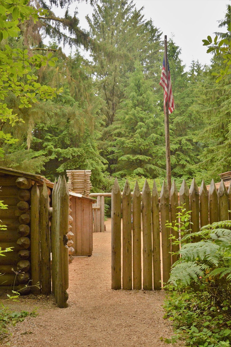
The area offered several advantages, including abundant elk, timber, access to freshwater, and protection from Pacific storms. Construction began in December 1805, and within a few weeks, the men completed a sturdy log fort they named Fort Clatsop in honor of the local Clatsop people.
Did You Know?
Although many people think Lewis and Clark 'discovered' the Pacific Northwest, the expedition relied heavily on the knowledge of Indigenous peoples throughout
the journey. Local Clatsop and Chinook people provided food, trade goods, geographic knowledge, and guidance that helped the Corps survive the winter of 1805–1806.

Four Rainy Months at the Edge of the Continent
Life inside Fort Clatsop proved far different from the triumphant arrival at the Pacific many visitors imagine. Rain fell almost constantly.

The expedition spent approximately four months living in cramped quarters while repairing equipment, preserving supplies, hunting elk, recording scientific observations, and preparing for the long return east.

The journals frequently mention wet clothing, muddy conditions, smoke-filled cabins, and deteriorating equipment caused by the relentless moisture. Despite these hardships, the expedition carefully documented their time in Fort Clatsop.

Those journals remain one of the most valuable historical records of the Pacific Northwest before widespread American settlement.

The Original Fort Is Gone
The original Fort Clatsop survived only a few decades before deteriorating and disappearing.
The structure visitors see today is a reconstruction based primarily on William Clark's detailed drawings and journal descriptions. Although not original, this 2006 replica faithfully recreates the scale and layout of the winter encampment, helping visitors appreciate how thirty-three members of the Corps of Discovery shared this remarkably small outpost during one of the wettest winters on record.

Exploring Fort Clatsop Today
The reconstructed fort is only one part of the experience. The visitor center contains exhibits describing the expedition, Indigenous cultures, navigation, wildlife, and the significance of Lewis and Clark's expedition.
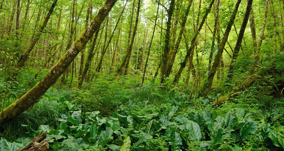
We took the opportunity to explore several of the forest trails in the Park. This was our introduction to Oregon forests and the countless shades of green stretching in every direction.

Walking beneath these massive trees helps illustrate just how different this environment was from the Great Plains and Rocky Mountains the expedition had crossed only months earlier.

Although today's forest has been shaped by more than two centuries of natural change and human activity, it still offers a glimpse of the lush temperate rainforest that surrounded the fort.
Why Fort Clatsop Matters
Fort Clatsop represents much more than the end of a famous expedition. Lewis and Clark successfully achieved the main goals of their mission by reaching the Pacific Ocean, mapping the region, and asserting their presence to claim the land legally. Furthermore, they formed diplomatic relations and trade agreements with over twenty indigenous nations. Although they never discovered the practical water route Jefferson hoped for, the expedition succeeded in nearly every other objective, fundamentally changing America's understanding of the West.
Planning Your Visit
Fort Clatsop makes an excellent stop if you're traveling between Astoria, Cannon Beach, and the Tillamook area. We explored the fort and several of the surrounding forest trails in about two hours, which is probably typical for most visitors.
Before leaving, take a moment to look beyond the fort itself. The forests, wetlands, and the nearby Lewis and Clark River continue the story, revealing how dramatically this landscape has changed since the Corps of Discovery spent the winter here.
Reading the Landscape
At first glance, the weathered wooden pilings rising from the Lewis and Clark River seem strangely out of place. Yet they tell an important chapter in the region's history. When Lewis and Clark arrived in the winter of 1805, they encountered vast old-growth forests stretching across the surrounding landscape. The towering Sitka spruce, western hemlock, and Douglas-fir provided the timber to build Fort Clatsop and sustained the expedition through the winter.
More than a century later, those same forests fueled one of the Pacific Northwest's largest industries. Millions of logs were floated down rivers like the Lewis and Clark, where they were corralled behind heavy cables stretched between rows of wooden pilings. These log booms served as temporary holding areas, allowing timber to be sorted before it was milled or loaded onto ships bound for markets around the world.

Today, the forests have largely recovered, the mills have disappeared, and only the weathered pilings remain. Like the reconstructed fort itself, they are reminders that landscapes preserve stories from different eras. Learning to recognize these clues transforms a simple visit to Fort Clatsop into something more than a history lesson. It becomes an opportunity to see not only the world Lewis and Clark experienced, but also how the Pacific Northwest has continually evolved over the past two centuries.

Explore Oregon's Iconic Coastline
Now that you've explored where Lewis and Clark spent the winter of 1805–1806, continue your journey south to some of Oregon's most breathtaking beaches and coastal landscapes.
Our Northern Oregon Coast guide highlights the region's most impressive sea stacks, scenic viewpoints, and hidden beaches. Then, deepen your understanding with our illustrated guide explaining how sea stacks form, from rocky headlands to sea caves, arches, stacks, and finally sea stumps.


