Southern California Hiking Bucket List: Pinto Mountain
- Feb 28, 2020
- 10 min read
Updated: 4 days ago
Quote for the Hike
'Mountains are earth’s undecaying monuments.' Nathaniel Hawthorne
Why Hike Pinto Mountain
Pinto Mountain isn’t the tallest summit in Joshua Tree National Park, but it may be one of the most challenging. With no maintained trail, difficult route finding, and a notorious rock wall guarding the upper mountain, this remote desert peak tested every skill we had developed over the previous year.
Hike Details
Location: Joshua Tree National Park
Trail Type: Loop Hike distance: 12.25 miles
Elevation gain: 2,519 feet
Prominence: 1253 ft
Difficulty: Very Strenuous
Terrain/Obstacles: Remote terrain, no established trail, rock scrambling and climbing, scree slopes.
Hike Breakdown: Hike only for well-conditioned hikers.
Highlights: Outstanding summit views, adventure rock scrambling and route-finding.
TrailsNH Hiking Difficulty Calculator: 248 - Very Strenuous

Click here for a review of prominence and its role in mountain topography
Click here to navigate to the TrailsNH website for a description of their hiking difficulty scale.
Here is the satellite view of the route to and from the summit of Pinto Mountain

In February 2019, while driving through the south entrance of Joshua Tree National Park, I was drawn by the stark, sweeping landscape of Turkey Flats and the imposing presence of Pinto Mountain rising from the basin.

I started looking into the hike and discovered descriptions that included warnings such as:
NOTE: Route finding for Pinto Mountain is extremely difficult and requires real off-trail navigation skills. Please use extra caution and research before attempting this hike. This is an extremely strenuous cross-country route to Pinto Mountain. Route-finding skills, a map, and compass are necessary to reach the summit. There is no official trail, and many hikers find themselves making several attempts before reaching the summit.
CAUTION: Be prepared with GPS track and a good topo map - there is a lightly used trail on the ridge, but it's essential to have route-finding skills.
However, I felt we had significantly improved our hiking and route-tracking abilities over the past year and were prepared to complete the summit climb.

Let's Start Hiking
The trailhead is situated on Pinto Basin Rd, which is the primary road from the southern entrance of JTNP. We began our journey by traversing Turkey Flats. Turkey Flats is essentially an extension of Pinto Mt., consisting of rock, gravel, and sand (alluvium) that has eroded from the slopes and canyons ahead of us. I've used an arrow to highlight Pinto, as it is nestled among the other mountain peaks in this part of the range. Our destination was the ridge indicated by the yellow arrow.

Without significant winter rains, the brush looks beaten down by the summer heat.

We are currently 1.25 miles into the hike on the Pinto Dunes, situated midway between the trailhead and the base of Pinto Mountain. These dunes aren't conventional; rather, they consist of a thin layer of fine sand atop an elevated ridge.

This sand-covered ridge delineates the boundary between two opposing faults that have been gradually separated over millions of years. The activity of these faults has resulted in the elevation of the Pinto and Hexie mountain ranges on either side. While we've shared several images of the Pinto Mountains in front of us, this picture features the Hexie range behind Dave, located on the opposite side of the basin.

Once we hiked the final 1.5 miles across the flats, we arrived at the alluvial fan at the ridge's base and started our ascent, a hike of over 3 miles to the summit with an elevation gain of more than 2,300 feet. This image captures the vast, empty stretch of the Turkey Flats.

This was our perspective looking up the ravine. While our initial plan was to follow the ridge, we opted for a lower path through the gully just beneath it. Throughout the morning, the white rock formation (circled in red) remained visible high above us. At first, it appeared insignificant, but as we climbed higher, it became clear that this feature would determine whether we reached the summit.

The first section of the ravine provided some fun boulder hopping, but as we continued our hike, we encountered more difficulties. As the ravine became narrower, the boulders grew significantly larger.


At several points, we needed to scale rock walls over 10 feet high, but luckily, we always discovered reliable hand and foot holds.

Route Finding Challenges
Approximately 30 minutes after entering the ravine, we encountered the 'white rock formation' we had spotted earlier. This rock wall, over 50 feet tall and nearly vertical, forced us to make a crucial decision about proceeding with the hike. We had to choose between finding a way up or around this barrier or retracing our steps a significant distance to find an easier climb out of the ravine. Although the picture suggests the hillside to the right might be a viable option, it was extremely steep and covered in scree. We never considered this a safe alternative.

REMINDER: This was how the 'white rock wall' appeared at the opening to the wash. At this point, we couldn't appreciate the magnitude and challenges we'd face to scale this wall.
After careful review, we opted to follow a route to the right of the wall. Dave took the lead, and things started well. People have described the area around the vertical wall as Class 3 scrambling.
Class 3: Hands, short fall. Class-3 is easy climbing. The route might be steep terrain or rocky outcrops where you need your hands. There would be lots of large handholds, and while Class-3 is easy and you wouldn't fall, a fall nonetheless would be short and result in injury but not death.

Despite making significant progress, we had to turn back when the path became more difficult than we felt comfortable handling.

We regrouped and found a new route to the left of the rock wall.

Even though the path was simpler, we knew it led us to a lip at the base of the vertical rock wall where we'd face another challenge. Would we be able to discover a way around the wall, or would we have to attempt climbing it?

Here's Dave on the landing/lip, evaluating potential routes to the top. From this angle, the wall does not seem very tall, but as the upcoming pictures reveal, it was quite the climb.

Dave spotted a steep route to the far left that seemed to skirt around the wall.

From the start, the route followed a roughly 45° incline.

The higher we climbed, the more interesting things became. After scaling the slope that was adjacent to the wall, we had to navigate a very narrow ledge and then climb over the 'white wall' to arrive at a secure landing area.


Success! As I neared our landing spot, I captured this photo of Dave gazing down the steep 'white wall'. The image also emphasizes how narrow the footing was in this final part of the climb. Take note of the rubberized gloves on Dave's hands. I had purchased these gloves to enhance hand grip for the challenging rock scrambling we expected to face on Pinto. They were incredibly effective.
Dave did an excellent job leading us to this point. Nonetheless, we couldn't celebrate because progress had been slow for a while, and we needed to increase our speed to reach the summit and get back to the car before nightfall.

As we ascended, the ravine veered to the left, and even though we were searching for a path that would bring us nearer to our planned route along the ridge line, we turned left.

Pausing for a moment to look back and appreciate how far we'd hiked.

As the landscape flattened and became less steep, we began to gain significant time.


We deliberately chose to turn left in the ravine and delay our climb to the ridge, since the terrain ahead appeared more favorable at this moment.

Along the way, there were a few fun spots.


Our confidence had increased significantly since the start of the hike. This was a 15' climb using small but secure holds that felt easy.
We followed this route for over an hour. This jagged rock outcropping signaled the beginning of our climb out of the ravine and onto the ridge.

It was a slow 25-minute climb on a moderately steep incline with unstable footing.

We enjoyed a fantastic view of the ridge line (curving from the center to the left) that was supposed to be our original path. I have a feeling it would have been an easier hike, but far less adventurous.

Since starting the hike, this was the first time we could see a faint outline of the trail.

We gained elevation quickly on the steep, winding trail.

There was a brief climb around a rock outcropping. Dave briefly lost his footing and almost face-planted into a cactus. Luckily, he just brushed against the cactus spines.

As we completed the rock climb, the summit plateau came into view.

Forty-five minutes after reaching the ridge, we were just a short walk away from the summit cairn.

Four hours after starting the hike, we had reached the summit.

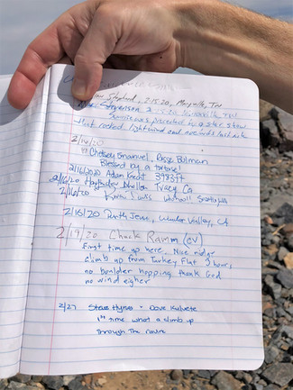
One detail that stood out to us at the summit was the register, securely stored in a sealed ammo can. After signing our names, we discovered that we were only the 10th and 11th visitors to reach Pinto Mountain in the previous two weeks. In a national park that welcomes millions of visitors each year, that number was surprisingly low and highlighted just how remote this peak really is.
Unlike Joshua Tree’s more popular destinations, Pinto Mountain attracts hikers willing to leave established trails behind and rely on route-finding, scrambling, and perseverance to reach the summit. Seeing so few names in the register gave us a greater appreciation for the challenge we had just completed. It wasn’t simply another hike in the park; it was an adventure that relatively few visitors choose to undertake.


Dave enjoyed lunch and the views from 3,983 feet. We didn't encounter anyone throughout the hike; having the summit all to ourselves was fantastic.

Being on the summit, surrounded by endless desert landscapes and the silence of the backcountry, we felt a deeper sense of accomplishment knowing that we had earned our place among the small number of hikers who had recently made the journey to the top.
The view looking west across the barren lowland of Pinto Basin. Like everywhere you go in the region, the summits of San Jacinto (10,834'; top center) and San Gorgonio (11,503'; far right) were visible.

The northern view of the Bullion Mountains (far left) is located in the Mojave Desert.

Before long, it was time for us to begin our descent. With no visible trail, we discussed which path to the wash seemed the most feasible. Here's another excellent picture of the Pinto Basin with Eagle Mountain in the background (left of center).

We start our descent on the scree-covered slope. Our target was the wash visible in the center and curving to the right.

The answer: On all fours. The question: How do you get down a steep, rock-covered slope with no secure footing? Dave demonstrates the technique. Each step we took, we slid 3 additional feet down the hill.

It would have been easier if we had used a sled, a snowboard, or skis on the hill.

It took us close to an hour to navigate the slope and reach the wash. The start of the wash was a welcome sight.

We felt more at ease once we arrived at the wash and returned to our usual hiking conditions. For me, this part can sometimes be the most difficult. The thrill of reaching the summit and overcoming challenges was behind us, and now it was just a lengthy, gradual hike through the wash and onward to the Turkey Flats.

The geology surrounding us was fascinating. I wish I had a better understanding of the subject so I could appreciate it at the time, rather than having to read about it later.


This was undoubtedly the largest ocotillo I have ever encountered. The spiny branches of the ocotillo (Fouquieria splendens) are a quintessential feature of the American Southwest. For much of the year, the long, thorny branches look gray and withered, but they burst into bright green leaves following rainfall. In the spring, vivid red flowers bloom at the tips of its branches, adding a colorful accent to the serpentine plant.

Eventually, the wash ended, and we began our trek across the Turkey Flats. We still had plenty of daylight remaining. Overall, it had taken just over three hours to hike from the summit to the Flats.


Around now, 'civil' twilight had set in. Despite the fading sunlight, we knew which direction to take to get back to the car. Dave felt relieved because the twilight limited my chances of taking more photos.

A final glance at the 2nd mountain on my bucket list that we conquered. Pinto is the third wide peak from the left.

By the time we got to the car, it was clear that night had fallen and darkness had fully settled in.

We had completed the Pinto Mountain loop hike in 9 hours and 25 minutes.

Job well done, and now time to head home for a supper and a post-hike swim.

Looking Back
Reaching the summit of Pinto Mountain was far more than simply checking another peak off our hiking bucket list. As the second hike was completed in this challenge, it marked another important milestone in our growth as hikers and outdoor adventurers.
Throughout the day, Pinto Mountain tested us in ways we hadn't experienced before. When our first attempt to bypass the steep white rock wall failed, we resisted the temptation to turn back. Instead, we reassessed the situation, searched for another option, and worked together to find a route that matched our abilities while pushing us beyond our comfort zone. With Dave leading the way, we successfully navigated one of the most intimidating sections of the hike.
The challenges didn't end at the summit. The difficult route-finding on the descent required patience, problem-solving, and confidence in our off-trail navigation skills. While our route may not have been perfect, we adapted to the terrain, trusted our judgment, and ultimately found our way back to the wash safely and efficiently.
Looking back, Pinto Mountain wasn't just a physically demanding hike—it was a valuable lesson in perseverance, teamwork, and adaptability. Those lessons would prove just as important as any summit as we continued working our way through our Southern California hiking bucket list.
Continue the Bucket List Adventure
Pinto Mountain is just one of three unforgettable hikes featured in our Southern California Bucket List Hikes series. If you're looking for your next challenge, be sure to explore:
San Jacinto Peak – A classic Southern California summit with breathtaking views stretching from the desert floor to the Pacific Ocean.
Mount San Gorgonio – Southern California's highest peak and a true test of endurance and determination.
Together, these three hikes showcase some of the region's most rewarding mountain adventures and offer a memorable progression for hikers looking to challenge themselves and expand their skills. Read the full stories here:


Great job and description of how you did it. I've only hiked the easy stuff at Joshua Trees NP but I love the Pinto Mountain Ranges. Heck. I love the entire area and would love to move there. And yes that Ocotillo is the biggest one I've seen too. Happy hiking!
I am in awe of you both accomplishing this Pinto Mountain hike. It's one crazy trail. The landscape reminds me a bit of Western Australia as it is so dry. A huge congratulations on this achievement.
Wow this is a serious hike. This is multiple times harder than the hardest hike I have ever done. Reading about the way up I thought "wait the guys have to go down again" - it makes sense you made your way down on all fours, at least partly. The geology does look super interesting and there's barely any vegetation to cover it up :)
Wow, this looks like it was hot and exhausting. Great work though, there's no way I could have managed it! The landscape looks so stunning and bleak.
We love JTNP! We've hiked Ryan Mountain (only about 3 mi RT, but for some reason, it packed a punch).This hike looks quite incredible and challenging. I've been boulder tumbling there many years ago, (I wonder if it was here). Thanks for sharing this hike! Loved reading your Glacier N.P. Hiking too!