Red Hill Vista Hike: Why the Mecca Hills Are Striped White
- Feb 20
- 14 min read
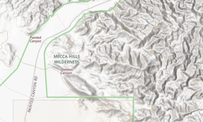
Welcome to the Mecca Hills Wilderness In the Chuckwalla National Monument
Stretching across more than 624,000 acres of the Colorado Desert in Southern California, Chuckwalla National Monument protects one of the most geologically dramatic landscapes in the American desert. Established in 2025, the monument links a vast network of mountains, desert valleys, and historic travel routes that stretch from the Mecca Hills eastward toward the Chuckwalla Mountains near the Arizona border.

While the entire monument is impressive, the Mecca Hills offer a unique display of tectonic forces colliding with erosion. The hills lie directly along the San Andreas Fault system, one of the most famous faults on Earth. Over millions of years, the relentless grinding, bending, and fracturing of the Earth's crust along the Pacific and North American plate boundary has forced thick layers of sediment upward, sculpting the rugged landscape of the Mecca Hills. This region is one of California's most accessible locations to get a firsthand look at the immense power of plate tectonics.
Why Hike Red Hill Vista
Hike Distance: 4.25 miles
Elevation Gain: 724 feet
TrailsNH Hiking Difficulty Calculator: 78 – Moderate

Click here to navigate to the TrailsNH website for a description of the hiking difficulty calculator.
There are hikes where the destination is a summit, a waterfall, or a slot canyon, and then there are hikes like Red Hill Vista (red map pin) where the destination is an overlook that offers a rare top-down perspective of the terrain. Looking down, you see the unmistakable red hills and the mysterious white stripes tracing across them. During today's hike, we'll explain how these white stripes formed and explore the geologic processes that shaped these hills. We'll also take note of the desert plants, including the Mecca aster, that thrive in this environment. Together, these elements tell a more complete story of this unique, ever-changing desert landscape.

Let's Start Hiking
Like most hikes in the Mecca Hills, the trail begins in a gravelly wash located on Box Canyon Road (UTM Coordinates for the trailhead: 33.587222, -115.955000).

A Green Corridor in the Desert
At first glance, the wash leading to Red Hill Vista looks improbably lush, but this green corridor is no accident. A desert wash is a natural water-harvesting system. During rainy events, storm runoff funnels down these canyons, briefly turning the wash into a stream. The deep, sandy, and gravelly soil allows water to filter downward through the soil profile rather than evaporating. Beneath the surface, moisture can linger for days if not weeks.

Ground Cover and Low Shrubs
Storm runoff not only delivers water but also deposits a new generation of seeds. Washes function like natural seed conveyors. Seeds collected from slopes and canyons are swept downstream by flash floods, settling in concentrated patches as the water slows. However, most plants require more than a single flash flood to trigger germination. While flooding can disperse seeds and deposit them in fresh sediment, successful germination depends on a specific combination of conditions.

Seeds need adequate rainfall beyond the initial storm to keep the soil moist for an extended period, not just briefly wet. Cooler temperatures, typically in fall or winter, reduce evaporation and stress on young seedlings. The seeds also require consistent moisture over several days or weeks, allowing them time to absorb water and begin growth.

In addition, they must be buried at the right depth. Deep enough to stay moist and protected from drying out, but shallow enough for the seedling to reach the surface.
Once these conditions are met, the seeds rapidly awaken, and wildflowers begin to sprout. Without this combination of conditions, seeds may remain dormant in the soil for years, waiting for the right moment in this unpredictable desert environment.

Perennial shrubs also respond to the pulsing rain events in the desert. These green cheesebushes are perfectly engineered for life in the disruptive wash environment. Adapted to thrive amid erosion and flash floods, cheesebushes dominate landscapes that are uninhabitable for many other plants. These adaptations include:
Flexible stems that bend rather than snap when floodwater or debris moves through a wash.
A shallow root system that anchors the shrub in loose sand while allowing it to survive partial burial; if sediment accumulates around the base, it can continue functioning rather than suffocating.
Rapid seed germination allows cheesebush to colonize washes before slower-growing woody shrubs arrive.

Canopy Vegetation
Desert ironwoods flourish in washes, utilizing deep roots to tap into consistent moisture and well-drained soil. These trees create a sheltered, 15°F cooler microclimate that protects young plants and seedlings from both extreme heat and colder temperatures.

Much like desert ironwoods, palo verde trees thrive in wash environments. They stand out with vibrant, photosynthetic 'green' bark. As drought-deciduous trees, they conserve water by dropping their leaves during dry spells, allowing them to rapidly utilize moisture and produce energy.

As the wash narrows into a canyon, creosote, lavender, and desert holly line the edge and slopes.


The Role of the San Andreas Fault System
At this bend in the wash, the earth stands almost upright. The pale bands in this tilted rock wall were originally horizontal sediment layers of the Palm Springs formation. They were deposited between 2.58 and 0.76 million years ago by ancestral Colorado River systems as they flowed into the forming Salton Basin.
Over time, the San Andreas fault's compressive forces tilted the once-flat sediments into near-vertical slabs that dip sharply to the right at 60°–80°. Even today, these beds continue to be warped by the fault movement.

Not all sedimentary rock layers in the canyon are tortured and tilted.

Heading deeper into the canyon, the rock face shifts, displaying a mottled, blotchy texture. This texture may have formed as slow-moving floodwaters deposited clay and silt, which later turned into weak sedimentary rock. These sedimentary rocks erode easily from the canyon walls, leaving behind a pockmarked, blotchy appearance.

At times, the canyon walls tower over Dave. The defining feature here is the distinct, brick-like horizontal bedding. Rather than forming from a single massive debris flow, this wall was likely built up by repeated flood events, each depositing a new layer and creating the stacked appearance.

Life on the Edge: The Story of the Mecca Aster
One of the quiet surprises in this canyon is the prevalence of Mecca asters, which pop up in small clusters rather than in massive carpets. For much of the year, these plants look like ordinary, drought-stressed shrubs, making them easy for hikers to overlook.

If you're lucky enough to spot it, pause and recognize that this shrub is endemic to the Mecca Hills region, existing nowhere else on the planet.

Why the Mecca Aster Grows Only Here
The Mecca aster’s confinement to these hills is most likely caused by a combination of factors. It may be that Mecca aster is a soil specialist that thrives in fine sand and silt that is well-drained, nutrient-poor, and unstable. These niche conditions found along the wash margins and eroded slopes are inhospitable to most other desert flora.
Evolutionary isolation and limited seed dispersal may have played a role in restricting the aster to this small geographic region. The Mecca Hills are physically separated from major mountain blocks. In addition, its seeds disperse short distances, mostly falling near parent plants. Over time, a population of a broader ancestral aster may have become isolated and adapted to this very specific environment and eventually became a distinct species.

A Brief Season of Color
Mecca asters don’t always look drought-stricken. Their green-up period is tied to late winter and early spring measurable rain events, not just trace showers. A single storm rarely produces a strong display. It’s cumulative moisture that matters. Soil moisture must penetrate beyond the few inches. Light rainfall that wets only the surface won’t trigger much response. Also, like many perennials, they react to increasing daylight and temperature triggers (moderate highs during the day and cool nights), not just water availability.

By late winter, small, rounded buds begin forming and slowly unfurl as the days grow longer.

Typically, blooms appear in late February through April. The lavender petals and their golden center provide a sharp contrast to the surrounding beige terrain.


This is not a super bloom spectacle. At peak, each shrub may hold a dozen or so open flower heads at once. When you see them in bloom, you are seeing a species whose entire world is measured in miles, not regions.

As temperatures rise, the petals wither and curl. The central disk dries and seeds mature within the head. The flower transitions from lavender to brown. By late spring, most seeds will disperse but settle close to the parent plant, reinforcing the species’ tight geographic range. By early summer, the leaves die off, and the shrub moves to a dormancy stage, awaiting the arrival of winter rains to begin again.

Vulnerability in a Warming Desert
Because the Mecca aster is endemic to these hills, its limited range makes it inherently more sensitive to environmental change than other widespread desert species. They would most likely be unable to shift northward or upslope easily, so a single prolonged drought could potentially affect the entire population. After all, they have nowhere else to migrate if conditions deteriorate.
Mature shrubs are resilient and may be able to withstand periods of extreme drought, but vulnerability lies more with seedlings, where we could see a dramatic decrease in seedling establishment. Hopefully, these beautiful flowering shrubs are more resilient than we assume.

Following the Wash Beyond the Blooms
The Mecca aster life cycle is brief, but the story of these hills goes on.

A mile later, we turn left, leaving the open wash for a tighter path winding through a series of low, mottled, and blocky textured walls.

Where the Gully Tightens
Within ten minutes of joining the trail, the canyon walls began to narrow. Unlike the mottled surfaces seen earlier, this section features smoother upper rock faces, suggesting a more strongly cemented layer. Additional evidence of this durability is seen in the embedded pebbles (lower left), which are firmly held in place, and the large protruding boulder (lower right), which remains securely anchored in the wall. When an erosion-resistant rock layer like this restricts flow, storm runoff energy is directed downward, gouging a narrow, deep slot rather than a wide gully.

Over the next several hundred feet, the trail shifts between a narrow cut and a rocky slope. This change in shape occurs because flash floods are slicing through alternating layers of well-cemented and poorly-cemented sedimentary rock. Each layer erodes differently, so the canyon widens, collapses, narrows, and then flattens again.


Stepping Onto the Bench
The trail climbs out of the drainage gully onto a broad level expanse that geologists refer to as a ‘bench’. A bench is created when a resistant rock layer slows erosion, leaving behind a relatively flat, stable landform.

Benches are characterized by a 'rock armor' (small pebbles to fist-sized stones) that protects the ground from ongoing erosion. Nearby mountain ranges began shedding these rocks around 4 to 2 million years ago. Ancient rivers transported the fragments here, where they were incorporated into the sediment layers of the Mecca Hills.

Many of the cobbles scattered across the bench have a dark desert varnish, which is a paper-thin mineral skin built from windblown dust and microscopic life. It forms so slowly that a rock like this may have been sitting here for tens of thousands of years.

Despite the sparse vegetation on the bench, tucked beside a rock, we found this 3-inch-tall fishhook cactus, its bristling spines protecting a single bright red fruit. It’s one of the desert’s smallest but most stubborn survivors.

I had never seen a beavertail cactus with pads so wrinkled and ribbed. This unusual appearance is likely due to drought stress and severe desiccation from growing on the exposed bench. For comparison, the plant on the left, located in a nearby gully, displays the typical, fuller pads of a healthy beavertail.


A Landscape of Layers
A second defining feature of a bench is that it is typically bordered by steep slopes on one or both sides and often provides sweeping views of the landscape. Perched slightly above the surrounding terrain, this bench offers a clear view of the winding washes and maze-like red hills with their white stripes, hence the name Red Hill Vista. How did this happen?
Rusty Hills
In desert geology, color is rarely random. The red hills owe their hue to iron oxidation. Many of the sediments, deposited millions of years ago by the ancestral Colorado River, contained small amounts of iron-bearing minerals. Following lithification, the sedimentary rocks were uplifted and fractured by the San Andreas Fault, exposing them to oxygen and repeated wet-dry cycles. This process oxidized the iron within the rocks, forming hematite, which gives them a deep brick-red color. The most intense red hues resulted from the longest exposures to oxygen. Put simply, the rocks rusted like metal left out in the rain.

The red coloration is also influenced by the site’s proximity to the most active fault strands, located about 1–2 miles south of the high ground at Red Hill Vista. In this 'fault damage zone', rocks are modified through intense mechanical fracturing. Fractures usually increase rock permeability, turning the damage zone into a pathway for fluids; this enhanced flow speeds up oxidation and deepens the red staining.

The classic shredded badlands landscape, captured in this photo, is created by these fractured red sediments that break down easily in water.

Chalky Stripes
The white bands that streak across the hills did not form during the original deposition of the sediment. Instead, they developed later within the soil as water moved through the sediments and precipitated calcium carbonate. These bands are pedogenic calcic horizons that formed in place within the older sediments rather than being deposited as a distinct strata or layer. These white bands don’t appear overnight. Here's a high-level summary of the slow process that builds them deep within the hills.

Source of the White Bands
The white bands streaking across the hills come from calcium in the sediments originating from ancient lake deposits, alluvial fan sands, and windblown desert dust. Rain and flood waters carry this calcium through the ground, and as the water slowly evaporates, the mineral is left behind.
Formation of Calcic Horizons
Over time, the calcium combines with carbonate in the soil and gradually hardens into solid calcium carbonate. It starts with calcium carbonate first coating individual grains, then forming small clumps, and eventually building into thicker, more continuous calcic horizons within the sediment.

Building the Cemented Layers
These calcic horizons develop slowly, requiring extended periods of minimal erosion and little to no new sediment deposition. They reflect a pause in deposition, a time when the landscape was relatively stable; a rare occurrence in the constantly changing terrain of the Mecca Hills. Over thousands to tens of thousands of years, repeated wetting and drying cycles gradually create the distinct white, cemented bands that form in place within the older red sediments.
Bleaching Enhances the White Color
Bleaching may have also contributed to the striking white color of the bands. As water moved through the sediments, it could have leached out iron and other pigments from the surrounding red layers, leaving behind a lighter, almost bleached layer. This process, along with the accumulation of calcium carbonate in the calcic horizons, further accentuates the white bands against the red hills.
Erosion Reveals the Calcic Horizons
Uplift and erosion eventually strip away softer, red sediments, exposing the harder calcic horizons.

Walking along the trail, we noticed scattered fragments of the calcic horizons underfoot. While these layers are harder than the surrounding red sediment, they’re not immune to the elements. Over time, the desert’s extreme temperature swings cause the rock to expand and contract, while water seeps into cracks and gradually forces them apart until weaker sections of the layer break away.

Science in the Field
To verify that these fragments belonged to the calcic horizon, I performed a simple field test. Calcic soils contain abundant calcium carbonate, which reacts with acid by producing carbon dioxide gas. When I dropped a small amount of dilute hydrochloric acid onto the surface, it fizzed as CO₂ was released.

Walking Along the Spine
As we hike further, the broad bench gradually tapers into a series of narrow, winding ridges. Geologists use the term 'lithologic interfluve' to describe a resistant rock ridge that is situated between two distinct washes. The slope on both sides of the ridge easily erodes and deepens while the ridge stands firm.

Small differences in sediment, cementation, and drainage can cause ridge widths to vary dramatically over short distances. Where the trail crosses a more resistant layer, the ridge stays stable and offers a wider walking surface.

When the interfluve crosses a soft or poorly cemented bed, the path quickly tapers. Because erosion occurs simultaneously from both slopes, the softer layer is cut back more rapidly than the harder cap above it. As the slopes retreat toward one another, the ridge tightens into a slender spine of sediment separating the two washes.

Given enough time, erosion will turn the interfluve into a knife-like ridge that inevitably collapses and renders the path impassable. All the more reason to hike Red Hill Vista sooner rather than later.

We continued to follow the ridge until we reached a large rock cairn. It’s a great spot to rest and enjoy the views.

Leaving the bench and interfluve behind, the route drops back to a major wash through a small drainage gully that's located close to the rock cairn.

Retracing the Work of Erosion - Returning to the Wash
The terrain begins to reverse the sequence we experienced on the climb to the bench.
The trail winds through layers of sedimentary rock that alternate between weaker and more resistant rock strata. This steep wall consists of weakly cemented mudstone and silt that is currently undergoing active erosion. The narrow vertical grooves running down the slope are called rills. They form as rain and runoff cascade down the slope. Each rill concentrates runoff, carving deeper grooves over time.

Shortly after leaving the bench, the trail cuts directly through a calcic horizon where we can clearly see how the calcium carbonate cement protects it from erosion.


Tall canyon walls often form through differential erosion, where layers of sediment with different strengths weather at different rates. In many areas of the hills, harder cemented beds (area between the green lines) erode much more slowly than the softer silts and mudstones sandwiched above and below. These stronger beds act like structural ribs within the cliff face, helping maintain the height and steepness of the canyon walls even as the softer material above and below continues to erode.

A tamarisk tree clings to the raised section of the wash, its roots laid bare by erosion and its survival uncertain. Once 20–30% of its roots are exposed, the risk of scalding, desiccation, and eventual death rises sharply.

A mile into the wash, the scenery shifts back to the tan sedimentary formations similar to those we saw at the beginning of the hike.

Fossilized Mud Cracks: A Desert Floor Turned Upside Down
Near the end of the hike, we came across another unique geologic feature: an overhead rock outcrop with well-preserved mud cracks. This erosion-carved opening along the trail exposes a mudstone layer, circled in red, where the mud cracks formed millions of years ago.
The lower rock unit beneath the mud cracks is a well-cemented, durable sandstone, while the upper unit, where the cracks formed, is a weakly cemented mudstone. Although the sandstone is stronger, the contact between the two layers is the natural weak point, so it’s not surprising that a major fracture has occurred here, exposing the ancient mud cracks.

What You Are Seeing
Looking up at the ledge, it takes a moment to recognize these aren’t random fractures but ancient mud cracks suspended, locked in time for 2-4 million years. They didn’t form above us. They formed on an exposed, drying mud surface, likely a floodplain, playa, or quiet basin. In other words, we’re not looking at a ceiling; we’re standing beneath a former ground surface. As the mud dried, it contracted and split into polygonal shapes. Later, new sediment buried this surface, protecting it. The cracks themselves were filled with sediment or minerals (now seen as darker lines), which helped preserve the pattern.
How It Ended Up Above You
Over time, the buried sediments hardened into rock. Tectonic forces later tilted and uplifted these layers. Erosion then carved into the hillside, exposing the mud cracks from below, so today, we are standing under an ancient land surface.

Mesquite and Metal: An Unexpected Desert Ending
Further down the canyon, we found this rusted car body. Desert dumping of cars is way too common, and I don't understand the motivation behind it.

Just before reaching the end of the trail, we passed through a stand of honey mesquite, a fitting close to a hike defined by outstanding geology and remarkable desert flora.

Snapping a quick photo to remember another incredible hike through the Mecca Hills.

Closing Thoughts
The Red Hill Vista hike is unique because it offers a rare top-down perspective of the landscape. While most hikes in the Mecca Hills wind through the bottoms of washes, this route climbs onto the ridges and interfluves above them. From this elevated vantage point, you can see the geology of the hills in a way that is hidden when you are surrounded by them in the wash. Looking down, you see the unmistakable red hills and the white stripes tracing across them. The contrasting colors reveal how water once moved through the ground, leaving behind mineral signatures that still shape our views of the hills today.
Red Hill Vista is definitely a hike that should be on your radar if you enjoy exploring and experiencing the geology of the Mecca Hills Wilderness area. You won't be disappointed. Here is the hiking route captured in an app.

200226


Comments